

MaxtDesign US Maps
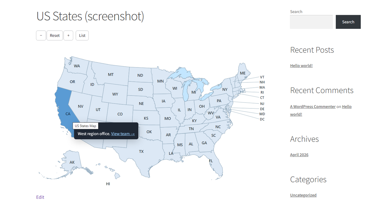
An interactive US states map on the front end, with a state highlighted and its tooltip showing.
MaxtDesign US Maps renders clickable, fully customizable vector maps with a near-zero front-end footprint: inline SVG, one small deferred script, no jQuery, no web fonts, and no external requests.
Features:
- Two built-in maps: US States (50 + DC) and US Federal Regions (10).
- Customize every area: up / hover / active colors, link, target, tooltip content, enable/disable.
- Global appearance: border, names, lakes, and territory toggles (Alaska, Hawaii, DC, callouts).
- Visual click-to-edit admin built on the WordPress block components.
- Unlimited maps per site. Insert with the MaxtDesign Map block or the
[md_usmaps id="123"]shortcode. - Accessible by design: keyboard operable, screen-reader labelled, WCAG 2.2 AA oriented, with a no-JavaScript fallback.
- One-click import from the legacy “US Map” and “US Regional Map” plugins.
Performance
Hover and active colors are pure CSS, so the map is correct on first paint with no JavaScript. The script loads only on pages that actually display a map.
Upgrade to Pro
Need more than states and regions? US Maps Pro builds on this free engine and adds:
- Drill-down / zoom — click a state to open its counties, or a country to open its regions, loaded on demand.
- Premium map packs — every US county, world countries, and US territories.
- Native lightbox — open rich content for any area in an accessible modal.
- Area grouping — combine areas into one unit that shares a colour, link, and tooltip.
- Document attachments — attach Media Library files to an area; they render as download chips in the tooltip and lightbox.
- Automatic updates — delivered straight to your site, licensed and signed.
The free plugin is fully functional on its own; Pro is an optional add-on. Learn more and get Pro: https://maxtdesign.com/plugins/us-maps
Security
Found a security issue? Please report it privately to [email protected] rather than posting
in a public support thread. We aim to acknowledge reports within 3 business days and will agree a
disclosure timeline with you.
Please include the plugin version, steps to reproduce, and the impact as you understand it. We will
credit you in the changelog unless you would rather stay anonymous, and we ask that you do not test
against a site you do not own.
This plugin is published on WordPress.org by the account slaacr, which is MaxtDesign. The account
name predates the brand and WordPress.org does not support renaming accounts, so the two names
differ. Anything published under slaacr is ours.