Interactive World, Europe & US Maps – Atlas Maps
0/5 (0 ratings) 10 active installs Updated Dec 20, 2025
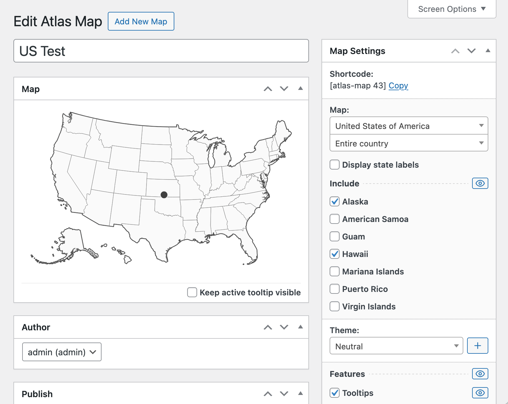
Editing an interactive US map with clickable states in the WordPress admin
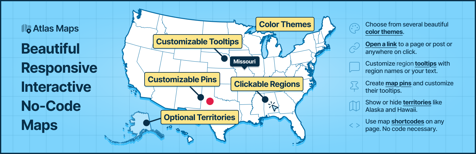
Atlas Maps is an interactive SVG map plugin for WordPress. Build responsive world, Europe and US maps with clickable regions, tooltips and pins in just a few minutes. Create interactive world maps, US state maps and Europe maps for navigation, directories, store locators and more — all inside WordPress.
Customize your map colors, tooltips and click actions directly in the WordPress admin with instant visual feedback, then embed your map anywhere using a simple shortcode. No coding required and no Google Maps or external APIs needed.
Features
- Quickly build an interactive world map with clickable countries, a US map with clickable states, or a Europe map with clickable countries for your WordPress site.
- Optionally show or hide Alaska and Hawaii on US maps.
- Create unlimited interactive maps and display them anywhere using shortcodes. No coding required.
- All maps use the correct projection out of the box.
- Maps are fully responsive and mobile-friendly.
- Edit maps in the WordPress admin with instant visual feedback.
- Choose from 3 beautiful built-in themes.
- Use click actions to direct users to any location when they click individual regions.
- Customize tooltips using dynamic fields (region name, country name, state name, etc.).
- Create up to 5 pins at any latitude/longitude location.
- Customize the pin tooltip with the same powerful formatting as region tooltips.
Pro Features
- 198 country maps including 26 territories, and 56 US state maps.
- Rich-text and interactive tooltips (clickable content inside the tooltip).
- Additional themes and a full theme editor to perfectly match your site.
- Per-region hover effects and color customization.
- Unlimited pins with configurable tooltips and shapes.
- See a live demo with all Pro features enabled.